


Review and Update of Flood Hazard Maps and Flood Risk Maps in the 3rd Planning Cycle
17 September 2025 r.
The State Water Holding Polish Waters has begun the second phase of the project “Review and Update of Flood Hazard Maps and Flood Risk Maps in the 3rd Planning Cycle,” which includes the development of flood hazard maps (FHMs) and flood risk maps (FRMs) based on the map review conducted in 2023-2024, as well as the review and update of the preliminary flood risk assessment. The project is co-financed by the European Funds for Infrastructure, Climate, and Environment for 2021-2027 and the state budget.
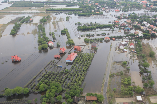
The aim of the project is to review and update flood hazard maps and flood risk maps in the third planning cycle, in accordance with the Water Law Act and the Flood Directive. Flood hazard maps and flood risk maps are planning documents for flood risk management, presenting flood risk areas and structures exposed to flooding in the event of a flood with a specified probability. These maps allow the assessment of flood risk to human health and life, the environment, cultural heritage, and economic activity. The project results will be used by local and central government administrations in Poland implementing statutory tasks related to flood protection, crisis management, and spatial planning and development.
The public availability of the flood hazard maps and flood risk maps will contribute to increased public awareness of flood hazards and risks. FHMs and FRMs provide valuable information for the public, especially those living in flood-prone areas or those planning to purchase property. The third planning cycle will include updating maps developed in previous years and preparing new maps for river sections identified in the updated preliminary flood risk assessment.
The scope of work includes, among other things, conducting new geodetic measurements, updating hydrological and meteorological data, and developing hydraulic models using HEC-RAS software. Spatial databases and cartographic versions of the maps will be prepared, along with documents describing the scope and method of updating the FHMs and FRMs. All maps will also be published on https://isok.gov.pl/hydroportal.html, ensuring that every citizen has access to them.