

The Flood Hazard Maps and the Flood Risk Maps in the 1st cycle (2010-2015)
The Flood Directive required the development of flood hazard maps and flood risk maps by 22 December, 2013.
|
In accordance with the Act of 18 July 2001 Water Law (Journal of Laws of 2012, item 145 with further amendments), the President of the National Water Management Authority is responsible for the preparation of FHMs and FRMs. Flood hazard maps and flood risk maps in the 1st planning cycle have been developed by the Institute of Meteorology and Water Management under the project “ISOK” funded by the European Regional Development Fund under the Operational Program Innovative Economy 2007-2013. |
Areas exposed to the risk in the preliminary flood risk assessment. |

On 22 December 2013, flood risk maps and flood hazard maps provided by the Institute of Meteorology and Water Management were published on the website “Hydroportal” in the form of PDF files.
In 2014, they were reviewed and verified. Remarks reported by administrative authorities were considered and, in appropriate cases, taken into account.
Final versions of the maps were delivered by the President of the National Water Management Authority to administrative units.
Cartographic version in PDF are available at: http://mapy.isok.gov.pl
FHMs and FRMs are available at map portal: https://isok.gov.pl/hydroportal.html
Flood hazard maps during the 1st planning cycle were developed for areas of potential significant flood risk indicated in the preliminary flood risk assessment (2011), included 253 rivers or river sections with a total length of 14.4 thousand km.
Report on the preparation of flood hazard and flood risk maps (2015) - archival
A detailed description of the methodology, scope and form of maps developed during the 1st planning cycle are described in the “Report on the preparation of flood hazard and flood risk maps” along with annexes available below.
Report on the preparation of flood risk and flood hazard maps
Annex no 1 Report - preparation of hydrological data
Annex no 2 Methodology for calculating the maximum water levels for the coast
Annex no 4 Attributive structure of flood hazard and flood risk maps
Annex 5 Description of metadata for flood hazard and flood risk maps
Annex no 6 Description of cartographic visualisation of flood hazard maps and flood risk maps
Annex 7 List of existing flood protection studies
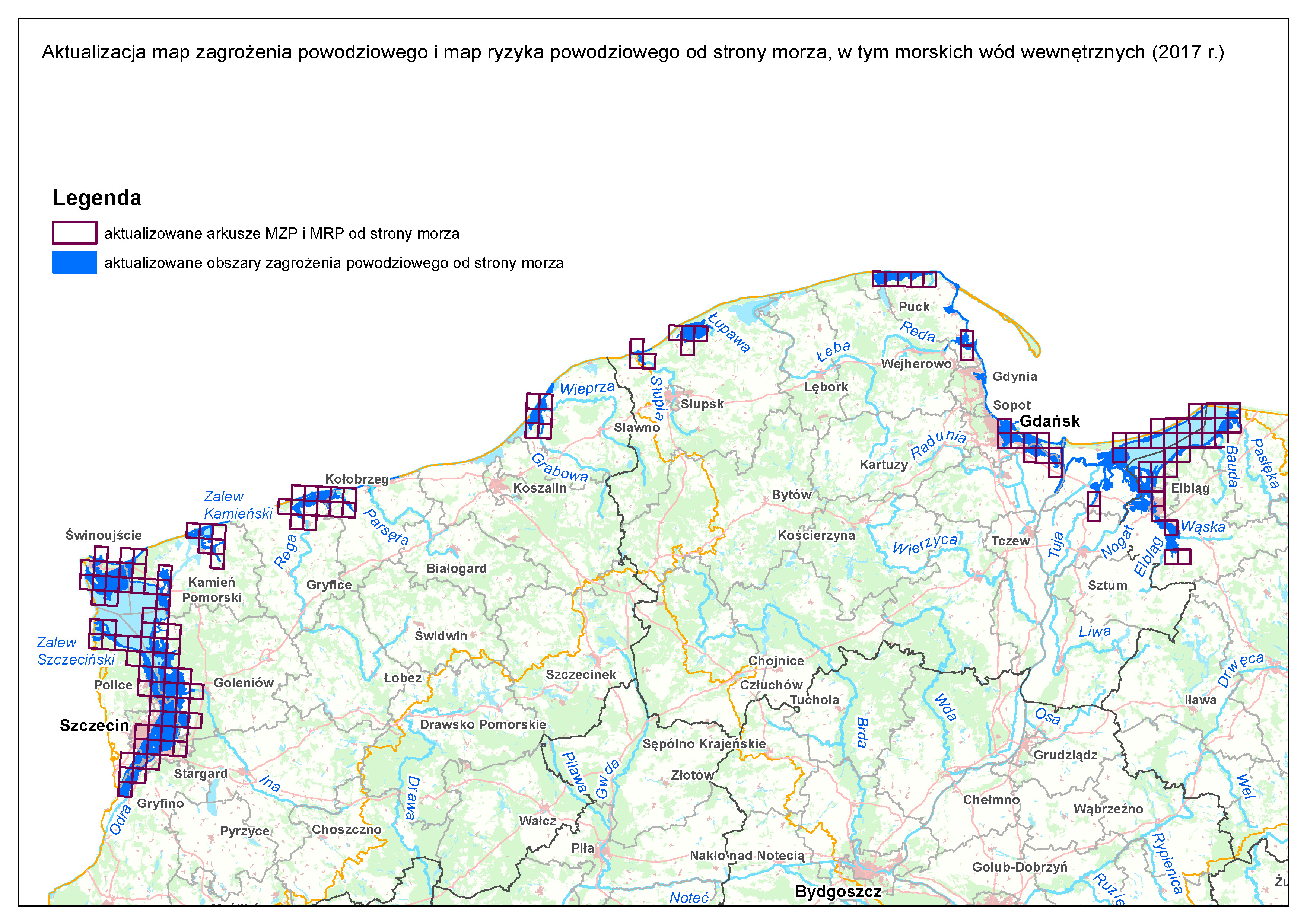
Update of flood hazard maps and flodd risk maps from the sea, including inland maritime waters (2017)
On the base of Water Law Act The President of the National Water Management Authority has updated flood hazard maps and flood risk maps from the sea, including internal maritime waters.
Maps were made available to the public (20 December 2017) at: http://mapy.isok.gov.pl.
The review has been prepared based on analyses carried out as part of the development of flood risk management plans. The description of the methodology and scope of the update includes “Report on the preparation of flood hazard maps and flood risk maps; Annex 1: Verification of FHMs and FRMs from the sea including internal maritime waters”.
Report on the verification of maps from the sea, including inland maritime waters - archival.
Below, there is a visualisation presenting the scope of the update of FHMs and FRMs from the sea, including internal maritime waters.